Monday, December 25, 2023

Rain expected December 26th Hampton Roads VA

 Forecast for rain December 26th and BIG temperature drop following Hampton Roads VA

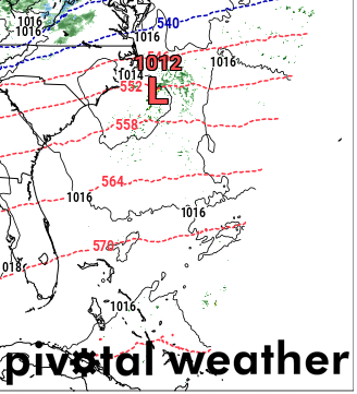
  Hope everyone is having a good holiday!  Wanted to post an update since there is some rain on the way.  Expect the rain to begin early Tuesday morning 26 December about 1am.  It will remain pretty steady, with a break Tuesday afternoon and possibly Wednesday morning.  Showers stay in the area until Wednesday afternoon around 3pm, when it gets the heaviest.  Possibility of elevated winds and some gusts up to 25 miles per hour.  The temperatures remain above average during the rain.

  Analyzed the short-range model to take a look at the timing of the rain.  As far as temperatures dropping, that's outside of the scope of the short range, so I utilized the longer-range European model.  Thursday night expect around 38 degrees, then steadily dropping in the lows to 32 degrees by the weekend.  Highs will be back to closer to average in the 50s.  

  Looking into climate models, this is expected for the area in the month of January and February.  This trend aligns with the strong El Nino pattern, and an active jet to the south, leaving room for the polar air from the North to sneak its way in.  These temperature trends may favor possibility for snow as winter progresses. 

  Since the temps were looked at long range, I'll keep an eye on them for changes.  If anything, expect a couple degrees margin of error.  

  Stay tuned for more updates! Thanks for reading.

NAMNST 06Z DEC 26 Precip

NAMNST 20Z DEC 27 Precip

ECMWF 12Z DEC 29 Temp

ECMWF 12Z DEC 31 Temp


Wednesday, December 13, 2023

Nor'easter to impact VA Coast Sunday December 17th

 Forecast for VA Coast Sunday December 17th into Monday December 18th


  Hello folks!  Wanted to take the time to post in regard to the upcoming weather that will impact the Virginia Coast Sunday night into Monday.  Since it's only Wednesday, the long-range models are what can be utilized to observe the system.  This presents a level of uncertainty; however, we can briefly go over the expectations.

  A surface Low is going to develop over the Mississippi Gulf and make its way North, crossing over Florida and impacting the Carolinas.  Since this month is above average temperatures, the Southern Coastal States or Virginia will not see a snow or ice event for this storm.  It will produce high winds and heavy amounts of rain, with potential for some severe weather in Florida.

  The GFS model has the system starting off stronger than the ECMWF, but overall moving slower.  This presents the potential for inland and coastal flooding risk.  The ECMWF has the system moving faster and getting stronger as it moves along the coast, with it not hugging as tightly along as the GFS.  

  Once it gets closer to the timeframe of the storm system developing the forecast models will tighten up a bit and come into more agreeance.  For now, just be on alert for the upcoming weekend, rolling into the work week.

  I will try to post more updates but am going out of town for the holiday so no promises, that's why I wanted to send the update now.  Hope everyone stays dry and enjoys their upcoming holiday!

Thanks for reading

Monday 06z GFS

Monday 06z ECMWF


Sunday 18z ECMWF

Sunday 18z GFS


Saturday, December 9, 2023

Forecast update for Sunday December 10th

 Forecast update for Hampton Roads, VA Sunday December 10th

  Expect temperatures to remain above normal Saturday through the rest of the day and getting even warmer tomorrow Sunday December 10th.  The warm air is creeping up from the south with the cold front pushing behind it.  So far today there is severe weather across Arkansas, Tennessee and Northern Mississippi.

  There will be spotty rain showers through most of the morning/day tomorrow for the Hampton Roads region.  The bulk of the heavier rain will occur in the afternoon, accompanied by high winds.  Be sure to secure any outside Christmas decorations so they aren't destroyed.  The wind gusts are expected to peak around 35mph Sunday night into Monday morning.

  For the morning commute on Monday there will still be remaining rain and high winds.  Current Gale warnings and marginal risk of severe weather are in effect. Temperatures after the front moves through slowly drop to average, starting off around 39 degrees.  Expect average December temperatures to remain throughout the rest of the week.

  Severe weather in December is more common with the jet stream in an El Nino climate pattern.  Higher than average temperatures also play a role in the active weather pattern coming to fruition.  Stay tuned to local weather warnings and stay dry!  Thanks for reading.


Monday morning wind gusts

Monday morning temperatures

Sunday afternoon precip


Thursday, December 7, 2023

Forecast for Sunday December 10th

 Forecast for Sunday December 10th in Virginia


  Visiting the NAM model guidance for the upcoming weekend, it's still a bit too short range.  Observing the GFS and ECMWF longer range for the upcoming weather pattern showed the trough digging deep down into Texas with cold air aloft interacting with the Gulf stream warmer temps.  This will develop a Surface Low, shifting across the states from West to East as the jet stream carries it along.

  The impact for the Virginia region is the warm side, resulting in a squall line type of rain, high wind and possible storms for Sunday night into Monday morning.  The models will continue to hone in on the timing and where the front will have the most impact when it is within the short range models.

  The temperatures drop Monday night as the cold dry air settles in.  Expect low temperatures to remain in the 30s throughout the week, with highs back to average 50s.  It is getting close to the time of year when the jet stream for the El Nino pattern settles into the south, and typical winter temperatures should remain more consistent the rest of the season for Virginia.

  I am keeping an eye on the winter season outlooks, where there is potential for even lower temperatures in January.  Time will tell if we see snow this year, after the long 3-year stretch of La Nina, which kept the snow out of the area.

Stay tuned for more forecast updates!  Thanks for reading!

surface low developing East of Texas

GFS model temps Monday night


Weather Prediction Center Day 3 outlook


Monday, December 4, 2023

Forecast Wednesday 12-6-23

 Weather forecast for Wednesday December 6th, 2023, East Coast/VA USA:


  Rain is expected to impact the Virginia coastline area Tuesday night into Wednesday morning, and some spotty precipitation through the afternoon.  A Coastal Low develops off the coast of Carolina early Tuesday, but due to a strong trough ejection in the jet stream, it is pushed offshore and just leaves some rain behind.

 A surface low develops over the Chicago area Tuesday night, resulting in snow over the Lakes and into Ohio, Pennsylvania, West Virginia and the western Virginia mountains.

 The NAMNST model is the most reliable to me, although everyone has their preferences.  The GFS and EURO never seem to do well at picking up on accurate temperatures and any changes in the atmosphere during an active weather pattern.  But the weather doesn't always do what the models pick up on.

The temperatures in the Virginia coastline region have been above average for November into December but expect them to drop off back to average Monday night into Tuesday and ongoing the remainder of the week.  

This ridge in the West and trough pushing off the East may be the driving force behind the signal for a more significant weather pattern for the upcoming weekend, but we will take a look Thursday and every day thereafter to check for consistency within the models.  Don't want to get ahead of ourselves.

Below are some images I captured utilizing pivotal weather 3kmNAM models, looking over the 700mb jet stream, 850mb temps and wind, as well as the surface temperature and precipitation products.

Be ready to bundle up as the temperatures drop and have your umbrellas!  That'll be all for now, stay tuned for more updates, thanks for reading!

700mb trough

850mb Wind and Temp

Surface Temps

Low being pushed offshore by trough


Friday, December 1, 2023

Winter snowfall analysis 2023-2024

 I recently did an analysis on forecasting snowfall for the winter 2023-2024 season in the Northeast US.  Data was extracted for snowfall totals by day for the Phildaphia,PA area and Norfolk, Va area with records dating back to the 1800s.  I highlighted areas of snowfall totals above average and looked at the ENSO climate pattern as well as the Pacific Decadal Oscillation(PDO) from those time periods.  I then compared it to the current conditions.

  The current climate pattern consists of a strong El Nino and a strong positive PDO. The only other year found to have close climate patterns to what current conditions are, was December 2009.  In that time, a Noreaster that developed over the Gulf of Mexico traveled up the East Coast and battered the Northern Virginia area, Philadelphia, New Jersey and several states in between with 20+inches of snow.

 With these results, I believe this year will result in at least one Noreaster that will have an impact on the East Coast. The jet stream pattern of typical El Nino shows comparable signal of higher than average temperatures for the area in December and higher amounts of precipitation.  This data suggests that a storm may not occur in the same month as 2009, however once I analyze the temperature patterns for similar years I believe the climate pattern will support a severe winter weather storm later on in the year, perhaps into 2024.

I plan to continue to analyze the data and monitor month by month and compare through the winter with current conditions, and those of past similar years. I also don't expect this analysis to result in the exact forecast I predicted. More info to come! Stay tuned!

   Sherri

Tropical Storm Debby

 Potential for Tropical Storm Debby to impact Hampton Roads    The first potential tropical storm to impact our area is brewing off the Flor...