Winter weather outlook
Hello everyone! I wanted to take some time to share my winter weather analysis for the upcoming 2024-2025 season. I read over the Climate Prediction Center's outlook and I agree with their analysis, so I will share that article here:
Since I had previously extracted snowfall data for previous years in Norfolk Virginia, I utilized that data again and looked over what our climate pattern looks like now and is forecast to be in the winter months ahead. Currently, there is a slowly developing La Nina, and it most likely will be weak when it does emerge. We will not have a full reading on the development of La Nina until the end of November, however it is forecast to develop. What this means is the jet stream pattern will favor severe weather in the southeast, more moisture in the northwest, and above average temperatures for the far southeast into mid atlantic, and below average precipitation in the midwest.
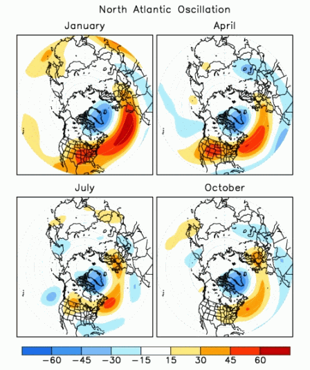
I also analyzed the Pacific/North American climate pattern or PNA. Currently we are in a positive PNA, which is associated with above average temperatures in the west, and below average in the southeast. The positive phase of PNA tends to be associated with El Nino while negative phases tend to be associated with La Nina. Now these teleconnections have opposite effects on the United States, however they all play a role into the data analysis.
The other winter months that had similar climate patterns to what we are currently experiencing include 2017, 1984 and 1974. This was late developing La Nina from moderately strong to moderate. 2017 and 1984 recorded no snowfall events for the Norfolk VA area. 1974 had a record of 7.5 inches fall in March, and there was a negative PNA. This tells us in 1974 there was an association with La Nina and the PNA. In 2024-2025 we very well could develop a negative PNA. What this tells me is, it seems that finding a direct correlation between snowfall occurring or not occurring and the climate patterns is not easy, and there may not be one at all. However, the pattern in 1974 shows a "movement to the right" if you will of a late snowfall in March. So, it's possible we remain above average temperatures through December, the cold pattern doesn't arrive until February, and we remain below average temperatures most of February and into March. We will see if it results in snowfall late in the season or not.
My winter outlook for the 2024-2025 season includes above average temperatures for most of the winter, a pattern shift from this current high pressure dry air over the mid atlantic, to an average/above average Dec-Feb-Mar precipitation pattern, with mostly rain as the temperatures remain above average. When it does cool down later in the season, there is a chance for storms to impact the area that could result in snowfall, but I do not think the pattern is conducive for a large impact storm or snowfall amount.
You can read more about the PNA and other teleconnections here:
Climate Prediction Center - Pacific/North American (PNA)
The 2023-2024 seasonal outlook from the CPC is here, in case you would like to read up on how accurate their last season outlook was:
2023-24 U.S. winter outlook: wetter South, warmer North | NOAA Climate.gov
You can read up on last season's results and my predictions in my earlier blogposts, from March 2024 and December 2023.
Thanks for reading!
Sherri


No comments:
Post a Comment