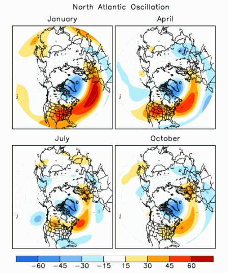
Monday, February 17, 2025

Preparing for the Winter Storm: February 19-20 Snow Update

Winter Storm Update: February 19-20, 2025

As we prepare for a major winter storm impacting the region from Wednesday, February 19, through Thursday, February 20, the weather models are showing a significant weather event on the horizon. Both the GFS (Global Forecast System) and ECMWF (European Centre for Medium-Range Weather Forecasts) models are in agreement about the storm's track, so we can be fairly confident in the forecast. Here's everything you need to know about the storm and how to prepare for it.

Track and Timing

The storm is expected to begin in the Mississippi Delta, with snow spreading into the region as it moves eastward. This is a large system that will be picking up snow from the west and will first impact Kentucky before heading toward our area. Based on the forecast models, we expect snow to arrive as early as Wednesday, with conditions worsening through Thursday.

Snow Totals and Impact

While the exact snow totals are still being fine-tuned, we can anticipate significant accumulation. Current forecasts indicate anywhere from 6-8 inches in the Norfolk and Tidewater areas, with some areas seeing up to 8-12 inches. The snow totals are a result of a well-supported weather pattern, but don’t be surprised if there are slight adjustments as we get closer to the event. It only takes a 50-mile shift in the storm's track to alter snowfall totals significantly.

To put this in perspective, while we may not see the 20+ inches that the December 2010 storm dropped, even a modest 2 inches of snow can have a major impact on the Hampton Roads area. This storm is expected to be impactful, so make sure you stay prepared!

Winter Storm Warnings and School Closures

Winter storm warnings and advisories are likely to be issued later today and into tomorrow. Expect school closures beginning Wednesday, with the possibility of schools remaining closed through the week. Plan accordingly and be prepared for possible disruptions to your regular routine.

How to Prepare

It’s essential to stay informed as this storm develops. Keep an eye on local weather reports and updates from the National Weather Service (NWS). While it’s not necessary to panic-buy at the grocery store, make sure you have enough essentials to get through the week, just in case conditions get severe. If you don’t already have a snow shovel and some salt, now is the time to invest in these items.

VDOT will be out treating the roads, but be patient and avoid passing plows in an unsafe manner. Their job is to make sure the roads are safe when you need to travel, so allow them to do their work. If the weather stations advise you to stay off the roads, it’s important to heed those warnings. Travel should only be attempted when absolutely necessary.

Safety Kit Check

With dangerously cold temperatures accompanying this storm, now is a good time to check your home and car safety kits. Make sure you have blankets, flashlights, batteries, and non-perishable food items in case the power goes out or your heating system fails. Don’t forget to check in on elderly family members, friends, and neighbors, as they may need extra assistance during the storm.

Conclusion

This winter storm is shaping up to be a significant event, so be sure to stay tuned to local weather information for the latest updates. I will continue to monitor the situation and provide additional information as it becomes available. Stay safe, stay prepared, and thank you for reading!


Sunday, February 16, 2025

Brace for Impact: Wednesday’s Snowstorm and What It Means for Hampton Roads

 Winter Storm Potential: What to Expect This Wednesday

Here we go again! It feels like just yesterday we were dealing with rain every weekend during the spring and summer. Now, it's snow every Wednesday!

As we look ahead to the coming storm, it’s clear that predicting its exact impact is no easy task. We're currently 76 hours out from the event, and although the GFS and ECMWF weather models agree on the general track of the low-pressure system, there’s still a lot of uncertainty about how strong it will be.

The Strength of the Storm Matters

Why does this matter? The strength of the surface low directly affects the amount of precipitation. A stronger storm system can bring more snow, sleet, or ice. The key factors that will shape how much and how long the precipitation lasts are the storm’s track, speed, and strength. If the low-pressure system tracks further south, it will increase the chances of snow and ice in the colder, northwest quadrant.

When and Where Will the Low Form?

The models are predicting that the low will form overnight on Tuesday into Wednesday morning (around midnight), just south of Mississippi and Alabama. If the storm follows the model’s predicted track, strength, and speed, we can expect more accurate forecasts for snowfall amounts. However, I’m not going to discuss specific snow totals just yet because they will likely fluctuate as we get closer to the event.

One thing is certain: the air will be cold enough for snow. The critical factors now are the exact track, speed, and strength of the storm. I’ll be monitoring the weather models over the next few days to see if they stay consistent and confirm the location where the low will form.

What the Models Are Showing

I’ve been analyzing the latest 06z model runs for both the GFS and ECMWF, as these are the best models for tracking storms 72 hours and further out. In the coming 48 to 24 hours, I’ll start comparing short-term models for more specific predictions. Below, I’ve included model animations and comparison tools so you can get a better idea of how the storm’s track is being predicted.

Be Prepared for Weather Disruptions

As always, be prepared for school closures and potential commuting impacts. While the models are becoming more consistent, the storm's exact track and intensity could still change slightly as we get closer. Keep an eye on your local weather stations for updates in the coming days.

Thanks for reading, and stay tuned for more weather updates!


Sunday, February 9, 2025

Hampton Roads Snow Potential: What to Expect on February 11th


Winter’s Not Finished Yet: What to Expect for Hampton Roads on February 11th

Winter has more tricks up its sleeve, and its aiming for Hampton Roads! There’s been quite a bit of buzz about potential snow in the forecast for Tuesday, February 11th, so let's break it down and see what we’re really looking at.

Uncertainty in the Forecast

Although we’re close to the day of the event, uncertainty remains high due to the temperature gradient. Down to our south, things are warmer, but the winds are arriving from the north, bringing a bit of cold air with them. The biggest challenge for forecasters is pinpointing the exact line where temperatures hover at or just below freezing, which determines if we'll get snow or just plain rain.

Coastal Forecasting Challenges

Forecasting along the coast comes with its own set of difficulties. The warmer ocean temperatures and sea breezes can play a huge role in moderating the cold air from the north. When these factors clash with the winds from the west, they create a tricky situation for determining whether that precipitation will fall as snow or rain.

What the Models Are Saying

The models aren't in perfect agreement, but here’s what we can gather from the data.

·         The 06z GFS model runs show temperatures above freezing, but still predict snow. This suggests a mixed bag of rain and snow, though accumulation is likely to be minimal (if any). We’re talking about a trace of snow or less in most areas.

·         The 00z ECMWF model runs also show warmer-than-ideal temperatures for snow, leaning more toward rain than snow. In fact, the soundings from the GFS—essentially a snapshot of atmospheric conditions at various levels—suggest that rain is the most probable form of precipitation.

In short, we’re likely to see a mix of snow and rain, but little to no accumulation. The main concern could be some icy patches if temperatures hover near freezing, so keep that in mind when you head out.

Looking Ahead: Beyond February 11th

According to the Climate Prediction Center’s outlook for the month, we can expect above-average temperatures in Hampton Roads. However, there might be more precipitation than usual. Fingers crossed we get a break from the winter weather soon—many of us are ready to say goodbye to snow and ice for a while!

Final Thoughts

While it’s always fun to track a winter storm, it seems like we’re in for more of a nuisance than a full-blown snow event on February 11th. Stay safe, keep an eye on the forecast, and be ready for a potentially slick morning commute.

Check out the weather models and soundings below for a deeper dive into the forecast data.

Thanks for reading!


Sunday, January 19, 2025

Freezing cold temperatures upcoming

Frigid temperatures are the headline - not snow

  Good Morning!

   While I missed blogging on the more impactful snow that hit the area a couple weeks ago, I wanted to ensure I highlight the upcoming, FRIGID temperatures along the Mid Atlantic and east coast.
 
    There was/is signal for snow in the Hampton Roads area Tuesday night into Wednesday when the MAJOR impact SOUTH snow storm will be there, however the model has changed drastically from its bullish snow totals and now shows the storm moving off the coast/being south and impeded by dry air.  Looking at the dew points is vital because if there isn't moisture in the air then no precipitation can develop or it will evaporate before it reaches the surface.

  The big story with this storm is the ARCTIC blast of frigid air arriving.  It will result in teens and single digit temperatures and stick around all week.  Any snow that does fall will not have the opportunity to melt, and any moisture will freeze.

    While there still lies uncertainty in the models of any snow, there is rain in the area today.  When the frigid air moves in it is dry.  There is a very small amount of moisture just off the coast showing on the models now, indicating the possible precip from the EURO model.  Looking like confidence of major Hampton Roads area impact is decreasing.

  Below are the model images that were reviewed this morning, to include snow totals (not 100% accurate), and the frigid temps moving in.  The snow totals are shown to give a better picture of the potential path of the storm.

  Stay warm and thanks for reading!


Saturday, November 2, 2024

Winter outlook 2024-2025 Season in Mid Atlantic

 Winter weather outlook

  Hello everyone!  I wanted to take some time to share my winter weather analysis for the upcoming 2024-2025 season.  I read over the Climate Prediction Center's outlook and I agree with their analysis, so I will share that article here:

U.S. Winter Outlook: Warmer and drier South, wetter North | National Oceanic and Atmospheric Administration

  Since I had previously extracted snowfall data for previous years in Norfolk Virginia, I utilized that data again and looked over what our climate pattern looks like now and is forecast to be in the winter months ahead.  Currently, there is a slowly developing La Nina, and it most likely will be weak when it does emerge.  We will not have a full reading on the development of La Nina until the end of November, however it is forecast to develop.  What this means is the jet stream pattern will favor severe weather in the southeast, more moisture in the northwest, and above average temperatures for the far southeast into mid atlantic, and below average precipitation in the midwest.


  I also analyzed the Pacific/North American climate pattern or PNA.  Currently we are in a positive PNA, which is associated with above average temperatures in the west, and below average in the southeast.  The positive phase of PNA tends to be associated with El Nino while negative phases tend to be associated with La Nina.  Now these teleconnections have opposite effects on the United States, however they all play a role into the data analysis.

  The other winter months that had similar climate patterns to what we are currently experiencing include 2017, 1984 and 1974.  This was late developing La Nina from moderately strong to moderate.  2017 and 1984 recorded no snowfall events for the Norfolk VA area.  1974 had a record of 7.5 inches fall in March, and there was a negative PNA.  This tells us in 1974 there was an association with La Nina and the PNA.  In 2024-2025 we very well could develop a negative PNA.  What this tells me is, it seems that finding a direct correlation between snowfall occurring or not occurring and the climate patterns is not easy, and there may not be one at all.  However, the pattern in 1974 shows a "movement to the right" if you will of a late snowfall in March.  So, it's possible we remain above average temperatures through December, the cold pattern doesn't arrive until February, and we remain below average temperatures most of February and into March.  We will see if it results in snowfall late in the season or not.

  My winter outlook for the 2024-2025 season includes above average temperatures for most of the winter, a pattern shift from this current high pressure dry air over the mid atlantic, to an average/above average Dec-Feb-Mar precipitation pattern, with mostly rain as the temperatures remain above average.  When it does cool down later in the season, there is a chance for storms to impact the area that could result in snowfall, but I do not think the pattern is conducive for a large impact storm or snowfall amount.

You can read more about the PNA and other teleconnections here:

Climate Prediction Center - Pacific/North American (PNA)

The 2023-2024 seasonal outlook from the CPC is here, in case you would like to read up on how accurate their last season outlook was:

2023-24 U.S. winter outlook: wetter South, warmer North | NOAA Climate.gov

  You can read up on last season's results and my predictions in my earlier blogposts, from March 2024 and December 2023.

  Thanks for reading!

          Sherri


Sunday, October 27, 2024

A Look at the 2024 Atlantic Hurricane Season


  Can the ENSO data be used to determine/forecast the Atlantic hurricane season intensity?  The answer is yes and no.  There are many factors leading up to an active hurricane season, and the ENSO analysis helps determine the strength of the sea surface temperature anomalies during the season.

  Comparing the 2005, 2020, 2021 and 2024 Atlantic Hurricane Seasons helped paint a better picture as to how different these ENSO analyses were.  To recap, an El Nino seasonal pattern means the Atlantic is experiencing warmer than average ocean temperature anomalies in the measured regions.  These are measured in 3 month increments.  The La Nina indicates below average sea surface temperature anomalies in the measured zones.  Not every historic hurricane season in the Atlantic is associated with a warmer than average SST.  There is actually more proof that the hurricane season is more active during a neutral ENSO phase or transition to El Nino or La Nina.  Not one is favored to have a more severe hurricane season than the other.  The only data set that shows more intense/active hurricanes in the Atlantic is the neutral phase.  Which proves that during NORMAL SSTs, the Atlantic hurricane season is more active.


In 2005, the Atlantic Hurricane season reached a historic record with tropical systems running into January 2006.  The winter season of 2005 started off with a low end El Nino, transitioned to a neutral phase into spring and summer, then a low end La Nina by the end of the year/beginning of 2006.  The 2005 Atlantic hurricane season had a total of 28 named storms, including 2 major hurricanes in July, 1 major in August, 2 in September and 2 in October.  This season included Katrina, Dennis, Maria, Wilma (record breaking pressure readings), Rita, and the infamous Greek alphabet names due to reaching the limit on the English alphabet names.


In 2020, there was a record breaking 30 named Atlantic Hurricanes, including a major in August, September, and 4 majors in October, already using the Greek alphabet by then.  This season included Laura, Teddy, Delta, Epsilon, Zeta, Eta and Iota.  This season kicked off early in May and ran until almost Thanksgiving with the last tropical systems being named a week before.  The climatological analysis of 2020 starts the year off in neutral phase, transitions to weak La Nina in late summer, and then began the 3 year long La Nina streak.


In 2021, there were 21 named Atlantic Hurricanes, including 2 major hurricanes in August (Grace and Ida), Larry the major hurricane going into September, as well as Sam.  The season again started with tropical development in May and ended in the first week of November.  The 2020 ENSO is mentioned above, and the rest of 2021 was in La Nina.  This is COOLER than average SSTs.  This hurricane season was toned down a bit compared to 2005 and 2020 however 21 named storms is still a high number.


For 2024 season so far, we have had 13 named Atlantic storms, including 1 major in June, 3 hurricanes in August/Sept, 2 major hurricanes in Sept, and 1 major hurricane in October.  Now the Atlantic Hurricane season isn’t over until November 30th, but as history shows us, this does not mean the tropics will no longer be active.  For this year’s ENSO analysis, we were finishing out 2023 from the long La Nina period, transitioned into neutral in winter/spring of 2023, then began El Nino in the summer, and now currently in a neutral phase with La Nina projected to begin this winter.


According to this data, there is no direct correlation between an El Nino/La Nina season and the strength/activity of the Atlantic Hurricane Season.  Yes, the ocean temperatures are warming, however above average SST anomaly seasons do not always result in a more active Atlantic Hurricane season.  I have found evidence that during a neutral ENSO phase is when the Atlantic Hurricane season is more active.  This also is not conclusive, not every neutral phase results in a more active season either.  Again, the wind shear, ACE, and PNO also have a factor in the intensity/activity of the Atlantic Hurricane Season.


Thanks for reading!


 ENSO analysis for Atlantic Hurricane Season 2005, 2020, 2021, and 2024.


Tracking charts for 2005, 2020, 2021, and 2024.

Sunday, August 4, 2024

Tropical Storm Debby

 Potential for Tropical Storm Debby to impact Hampton Roads 

  The first potential tropical storm to impact our area is brewing off the Florida coast.  It is expected to develop into a Hurricane before landfall, however once it reaches land it will be likely downgraded to a tropical storm.  The weather models are still in a bit of disagreement with how long it may linger at the Florida/Georgia border, however what we know now is that it will bring flooding rainfall.

  The risk associated with the Tropical Storm slowing down at the border will include storm surge as it makes landfall, and tropical rainfall amounts are astronomical when measured by weather models.  The amount of moisture and the storm spinning over an area for a longer period of time results in rainfall amounts equal to the area's entire years' worth of rain.  There will be strong winds as well, but the water and flooding potential will be the biggest threat.

  As far as impacting the Hampton Roads area, it is still a bit early to tell exactly what Tropical Storm Debby will do, however I can at least give information off the knowledge we have now.  Depending on how long it takes the storm to move up the coast, it may reach the North Carolina and Southeastern Virginia coastline by Friday into Saturday.  Since this area has already had above normal precipitation accumulation this season, the biggest risk associated with any tropical system moving into the area is flooding.

 The Hampton Roads area is at a marginal risk for excessive rainfall for the later part of the week, Wednesday/Thursday and into Friday.  This may be elevated once Tropical Storm Debby moves up the coast.  Even if the storm is remnants by the time it arrives, it will still drop tropical amounts of rain in the area.

 To prepare now for tropical storms affecting the region, have a plan in place for the need to evacuate if necessary, inventory your emergency kits now, and prepare for power outages with high temperatures.  Do not drive through flooded roadways or around barriers.  Monitor your local weather forecasts these coming days, as the forecast could shift and alter plans if needed.

  Below are latest images of weather models, Hurricane center imagery, ensemble means forecasts and resources.

  I will continue to monitor the storm throughout the week and post an update if necessary.  Thanks for reading!


Ensemble mean forecast ECMWF.  Each line represents a model scenario of the storm track.  The more lines in one spot, the more agreeance the ensemble has on location.  Do not use this image as a final determination of storm track, there is potential for adjustments.


Preparing for the Winter Storm: February 19-20 Snow Update

Winter Storm Update: February 19-20, 2025 As we prepare for a major winter storm impacting the region from Wednesday, February 19, throug...